We combine real-time flood forecasts with city data to deliver location-specific risk insights.
Where flooding strikes, disruptions follow. We predict both.

Water Treatment Facility Power Loss
Cell Tower Service Disruption
Hospital Loss of Drinking Water
Power Station Flood Zone
- Speed Ready in minutes
- Frequency 16-hour forecasts, updated hourly
- Resolution Neighborhood-level
- Historic Data Since Oct 2022
- Severity Estimates (Soon) From minor to catastrophic
- Impact Forecast Track cascading disruptions of flooding
Data Products
-
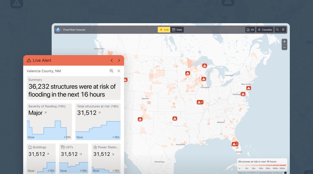
Real-Time Flood Risk Forecasts
We provide real time, fast, accurate flood forecasts, at the resolution you need, in a format you want, for the entire continental U.S.
Learn more -
Water-Energy Nexus
Our next-generation data infrastructure connects water and energy data and answers questions at their nexus.
Learn more


Solutions
-
For Government
Learn more -
For Business
Learn more


Our Technology
Human and economic losses from flooding are increasing — yet we still don’t fully understand the impact of urban flooding, or how to reduce it.
Why is that, and how do we solve it?
Cities are networks of networks: power grids, transit, water systems, navigation, dams—woven into the environment, economy, and public health.
We call this the Urban Multiplex.
While the Urban Multiplex is physically and functionally connected, the data produced within its individual sectors are not.
This prevents us from understanding how disruptions triggered by floods cascade across cities.
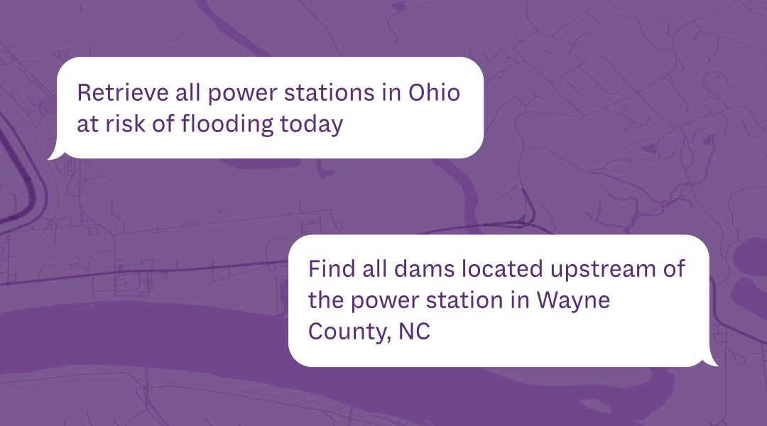
We integrate Urban Multiplex data in an intelligent, searchable Knowledge Network and connect it to our Real-time Flood Forecasts.
This way, we forecast when and where flooding is likely to happen and cause cascading disruptions — delivering actionable impact information in real time.
Start using our data today
APIs
Query our data programaticallyLLM
Use natural languageBespoke solutions
Software tailored to your needsEnterprise data management
[description]
Delivering Flood Impact Information to Anyone, Anytime, Anywhere™